Great Glen Way

I’m planning to walk the Great Glen Way and wild camp along the way.

For my long distance walk I’ve decided to walk the Great Glen Way. For it to count as the challenge on my list I have to complete it in one go and not just as a series of individual day walks. I also want to do it whilst carrying all my own gear. As I’ll be camping each night I’ll need to carry a tent, Thermarest, sleeping bag, stove, pans, etc as well as few toiletries and a couple of changes of clothes.

My walking in Exmoor last week was the start of my training towards this. I’ve been worried about my knees and whether or not they’ll hold up to walking consecutively over a week. I’m also not sure if I’m fit enough and strong enough to carry all my gear. I tried to carry a fairly heavy bag each day I walked in Exmoor and after a while I did ‘forget’ I was wearing it. My bag on the GGW will be a lot heavier though and more bulky, so I’ll have to do some training with this too.

My knees are going to be the biggest problem. I had to take two rest days in Exmoor. Each time was after a 15 mile walk with a lot of descent. I’m not too bad on the uphills – I can take short breather breaks if I need them – but the downhills are real killers. I walked slowly and used two poles but still had a lot of pain and swelling and later on stiffness in my knee joints.

One of the reasons I’ve chosen the GGW is because it’s only 73 miles so I should be able to keep most of my walks along it to a 10 mile maximum. Also, the first few days walking will be fairly flat. By the time I hit the descents I should have a lighter pack (I will have eaten away at the weight) and be more than half way there. I’ll take my poles and a stash of ibuprofen and will hopefully be able to complete it.

I’d like to combine my wild camping task with the long distance walking task. There are actual ‘official’ wild camps at some places along the route. Do they still count if they’re official? On some nights I will have to find my own wild camp though, so whether or not the official ones count, I’ll still be completing this task.

I’ve been googling the GGW to try to get as much information on it as possible. I’ve found a detailed blog from a few years ago, some general information sites and a very good photo diary on flikr. The photo diary in particular is good because it means I can see what the various bits of the route look like and how feasible it will be to camp along the way.

Now I just have to do more training, get a map and a guidebook, sort out train tickets and arrange to leave my car with a friend in Glasgow.

Wild Camping

Considering the possibilities of wild camping on the South West Coast Path.

As I walked along the Exmoor stretch of the South West Coastal Path I thought about how I would do the walk if I was doing it in one go rather than as a series of day walks. Most camp sites are a bit of the way off the path so would add a few miles walking to each day. Not something I’d particularly want to do. There was actually one campsite that the path went through and it had signs up saying hikers could camp for one night only on their way through for £4. Usual price being a mind-boggling £13 a night! It did say that this was for 2 people, but as there was nothing about prices for individuals it sounded like if I’d stayed here instead of Porlock I’d have had to pay for a non-existent second person as well as myself.

But, to get back to the main point, if I was walking this section in one go I would have had to wild camp on some of the nights. Much of the walking was through wooded areas that sloped upwards and downwards either side of the path, so there was really nowhere to fit a tent. This was particularly true on the first day’s walk when the only flat, clear bit seemed to be at the section where the path crossed the path leading to County Gate. This was a bit of busy area and so not ideal.

Between Minehead and Porlock it would have been possible to camp on the moorland, but this would have meant a very short day’s walking. The other stretches of the walk were similar in not having many appropriately placed areas to wild camp in.

I’m planning to wild camp on the Great Glen Way in the summer, so I hope it’s easier to find places than this!

Peregrine falcon

Caves, cheese and a peregrine falcon

I drove home from Exmoor via Cheddar. I’d walked around here a few years ago, but hadn’t been in the caves. As I like caves I felt like I’d missed out. I spent most of the day here and bought a day ticket which gave me admission to both sets of caves, the museum and an open top bus tour through the gorge. 


First I went into Gough’s Cave which I walked through with an audio guide. Unfortunately the audio guides, which are included with the price of the ticket, are aimed at children. It would have been nice to have had an adult version giving me facts about the caves rather than telling me ‘when my parents are ready’ to do this, that and the other! The caves were well worth seeing though, with lots of interesting formations. There were racks of cheeses maturing inside too. 


Next I went down the road to Cox’s Cave and the Crystal Quest. The name itself had me a bit worried and I was right. I know I was in Cheddar, but do things really have to be this cheesy? The cave was a lot smaller than Gough’s Cave and most of it was some kind of adventure quest with dummies and voices and sound effects leading you through in search of some kind of magic crystal. 


The museum was quite interesting as was the bus tour through the gorge. The guide pointed out a layby where the RSPB had a telescope set up watching a couple of peregrine falcons who had nested at the top of the gorge. When I got back to my car I drove back to the layby and stopped for a while to chat to the RSPB people and check out the falcons. I was just too late to see the male fly off and the female was nowhere to be seen. I decided to stick around for a bit and was glad I did. After a while the male reappeared and flew round for a bit before coming in to land. Once back on top of the gorge he was very difficult to see. But patience paid off and he took off again for another fly round before settling in a much more viewable position. 


He was wonderful to see, but if I’d been there without the RSPB pointing things out and making them obvious I’d probably have never noticed him. I’ve been trying to learn about birds for a while now. It would nice to know what it is flying past me when I’m out walking and I should be learning about all things nature-ish for my walking group leader’s qualification. I find it hard to identify birds as when I look in a bird book they never quite look the same. I’ve thought about joining the RSPB on and off for a few years now, and I think I really should. Their magazines might help me with gaining knowledge and I’d be quite happy to support them. But as I’ve spent way too much money lately, it will have to wait a while. 

Combe Martin to Ilfracombe

A short walk with plenty of time to sit enjoying the views.

My final day’s walking was a short one at just over 5 miles. I parked in Ilfracombe and took the bus back to Combe Martin. It was the same bus I’d picked up to go to Lynmouth yesterday so my walking start time was much earlier.

I’d had chance to have a brief look round Ilfracombe before catching the bus, but wasn’t impressed. It looks like a run-down seaside town with an abundance of cheap shops and takeaways, but little in the way of character. Not what I was expecting at all.

I started walking from Combe Martin by following a sea front path which quickly led on to the road. This is a main busy road and not particularly pleasant to walk along. After a while I was able to leave the road and get back on to proper paths. After walking round a bit of a harbour the path climbed and I was able to sit for a while at a wonderful viewpoint. It felt great not to have to be clock watching and instead to be able to sit and enjoy the view.

This part of the path is flooded at high tide

Honest! It’s England!

The view from a well-placed bench

Soon it was back to road walking again. The final section of the path took me back to the coast where I again enjoyed good views from a well-placed bench before descending back into Ilfracombe.

Although this was only a short walk today, and it had some not so good bits along road, it still took me most of the day. This is because of the amount of time I spent sitting and admiring the view along the nice coastal parts of the path.

Books

A few good book finds

On my days off from walking I went on a book hunt in Minehead’s charity shops and tourist office, and Dunster National Trust shop and got myself a few bargains.

I’ve got a few bird books but never take even the smallest of them out with me when I’m walking as I don’t want to carry the extra weight. Then I see a bird and want to know what it is. I look it up when I get home but by that time I don’t remember exactly what it looked like, just that it was small and brown (usually). My bird books have about twenty small, brown birds in them so I end up no wiser. 

So when I spotted the ‘I Spy‘ bird book in the tourist office I pounced on it straight away. It’s meant for children and is basically a tick list so they can tick off the birds they see, but it’s small, light, has clear pictures and basic descriptions and was only £2.50. I was so pleased I bought the one on wild flowers too. 

 I also picked up a printed out copy of the South West Coast Path Association’s guide to the section of the path I’m walking. It has quite a lot of detail and should be quite useful. 

Then I found a big, softback geology book which seemed quite simple. Most of the geology books I’ve looked at are categorised into sections that you have to understand before you can find anything. I really need an idiot’s guide to get me started off and so hopefully this will do the job. 

One of my best finds though, was in the secondhand bookshop in Porlock. I found a Reader’s Digest book on being a countryside detective. It’s big, chunky and hardback so definitely not one for the backpack. But it’ll be good to have in the car or to read at home. It beautifully laid out and is very simple; pefect for my level of inexpertise. it tells me what can be found where and how to find it. Wonderful. 

So all in all, a very productive couple of days book hunting.  

Lynmouth to Combe Martin

A funicular railway, rock formations, feral goats and breath-taking views.

This was my hardest day’s walk. It didn’t help that I had a late start. I didn’t want to be rushing to get the last bus like I was when I walked from Porlock to Lynmouth so I decided to leave my car in Combe Martin and get the bus back to Lynmouth and the start of my walk. This also made sense with the bus times as the last bus back from Combe Martin was very early. However, the first bus of the day only leaves Combe Martin at 9.40 and doesn’t arrive in Lynmouth till an hour later.


I got to Combe Martin in plenty of time and found a place to park my car. I had a bit of wander round looking for the bus stop but it really wasn’t obvious. The timetable just said ‘seaside’. I asked a lady walking her dog, but she was a bit unsure. Then I asked in the sandwich shop where I bought a sandwich for my lunch. The woman had a rough idea but again wasn’t completely sure. Then I asked a road sweeper who didn’t even know the buses were running. This particular service only runs in summer and had only begun the previous week. Luckily, just then a bus arrived going in the other direction, so I quickly ran across the road to ask the driver and he was able to point out the correct place to me. I was soon joined by another walker who was having a similar problem.

The bus seemed to take a long time and it was quite daunting to realise that I had to walk all that way back. Once in Lynmnouth I had a bit of a look around as I’d not had time to see anything last night. Then it was up the steep track, criss-crossing the funicular railway to get to Lynton way above.

At the top the path turns right and west to follow the North Walk. It’s starts along road but quickly becomes a path leading towards the Valley of Rocks. This is an area of strange rock formations, feral goats and a liberal sprinking of goat droppings. This part of the path was quite busy with families and older people out for a stroll. The path heads towards Castle Rock – an obvious outcrop with a nearby car park meaning lots of people. It was so sunny and warm I sat on a bench for while and chatted to a woman who was just there to see Castle Rock.

The path then joins the road which leads towards the Toll House and then to Lee Abbey. The road goes alongside the manicured grounds of the Abbey before heading into woodland. A short while later the path joined the road again. Soon though, it was back on tracks and over stiles to reach the coast. The wind had really got up by this time and it was so strong I tucked my sunglasses away thinking they might be blown off the top of my head where I’d stuck them. The walk along the side of the cliffs was stunning with amazing views in both directions.

The path turned inland and dropped down to sea level at Heddon’s Mouth. At the inner end there is a pub and a car park so this part of the path had lots of people including people with wheelchairs and pushchairs. I didn’t need to walk all the way up to the pub as about half way up the valley there was a bridge crossing the river so I could walk down the other side to reach the sea again. It zigzagged very steeply upwards and I’d soon regained all the height I’d lost. I followed the coast on a very exposed and windy section before turning inland across fields and then moorland to reach the rises of Great Hangman and then Little Hangman.

Finally it was back down sheltered paths to reach Combe Martin and my car. It was a long day, with lots of up and down including reaching the highest point on the whole of the SW Coast Path. But I’d seen some breathtaking views and felt like I’d had a year’s supply of fresh air.

13 miles
Graded as strenuous by South West Coast Path Association

Helicopter ride

Exploring the possibility of flying to Lundy Island by helicopter

I was thinking about going to Lundy on Friday. I like small islands and this one has interested me for a while. I noticed on the map that in summer the ferry goes from Ilfracombe which is where I want to finish walking my bit of the coastal path. 

I spent today, or at least this afternoon, wandering around Minehead; partly to give my knees a rest ready for my big walk tomorrow, but also to research logistics for my next few days walking. Whilst in the tourist office I picked up some leaflets on Lundy and then settled into a nice cafe (The Creamery) for a delicious late lunch and to study them. 


Unfortunately the times of the ferries are such that I’d only have four hours on the island. It’s 3 miles long and half a mile wide and there are quite a few things to see – seals, ruins, views. To circumambulate the island would be about 7 miles so it is doable in 4 hours, but I’d feel rushed and like I couldn’t stop to enjoy it. If I was staying longer I could get the ferry from Bideford instead and have about 8 hours on the island, but it’s not to be. And at £30 return with National Trust membership (more without) I don’t want to go for quick whiz round – I want to have time to explore properly. So that’s on hold. 

What was interesting on the leaflet though was the helicopter service. It seems to only be out of season and is £99 return. This is going on a Monday and returning on a  Friday. Maybe this would be too long for such a small place, but if I just wanted a relaxing half term to camp, walk, read, write and think then this could be good. 


When I tick the ride in a helicopter task off my list I want to actually go somewhere in the helicopter, not just do a scenic ride. I had intended it to be the Scilly Isles, but now Lundy is a real contender as well. 

Minehead to Porlock

A tasty pasty, an impressive sculpture, a baby squirrel, podgy ponies and another knee-quaking descent.

Today was a shorter walk of 7 miles. Minehead to Porlock – the first section of the South West Coast Path. The first bus of the day didn’t leave Porlock until late morning which is why I hadn’t done this section yesterday. I didn’t want to be hanging about all morning on my first day. This morning however, I was glad of the later start as it rained really heavily for most of the morning. By the time I was due to leave for the bus stop it was just a light drizzle and by the time I started walking it had stopped completely and ended up being a nice day. 

When I arrived in Minehead I called in Boots to buy some special tick tweezers in case any more ticks think I make a good lunch. Then I bought a cheese and broccoli Cornish pasty and wandered down to the seafront to eat it. I wasn’t sure where the walk actually started so just walked along the seafront in the right direction. A huge bronze sculpture of a couple of hands holding a map open to show the path in it’s entirety was a pretty big clue. That and big white writing on the pavement saying ‘South West Coast Path’ and an arrow. I was very impressed with the sculpture so stopped to take a few photos of it before starting the walk. 


The walk soon headed out of town and uphill into dense woodland. It was beautiful, but like yesterday, there were glimpses of the sea rather than a permanent view of it. There were plenty of grey squirrels and I stopped to watch a baby one playing in front of me seemingly without fear. The path zigzagged upwards until it flattened out onto moorland quite a way in from the sea. At one point I passed a sign pointing to a ‘rugged alternative path’ which seemed to go closer to the coast. The ‘rugged’ bit of the sign attracted me though I thought I should maybe avoid anything too rugged as my knees were still sore from yesterday and I knew I had some more descents to cope with before the end of my walk today. The clincher though, was the ‘alternative’ part of the sign. I didn’t really want to do any ‘alternatives’ unless I had to. The alternative could be saved in case I ever did this walk again. 

 It was a good decision as the moorland walk was lovely with lots of wild flowers and big skies. I even got to see some Exmoor ponies. I only saw a couple of other people the whole time I was on the moor. Of course it had to drop down though and my knees were soon objecting. One bit in particular seemed very steep and I descended very sloooowly saying ouch with each step. As I got nearer the bottom there was a well-placed and welcome bench with a lovely view of the sea. I sat for a while and finished my flask of coffee. 

Then it was the final bit of descent before picking my way across farmland and marsh to the turnoff back up to Porlock. This bit wasn’t very well sign-posted and if I hadn’t have started my walk from here yesterday I would have missed it. So if walking here make sure you use your map!

The total descent (and climb) on this section is allegedly 698 metres. No wonder my knees hurt again.  


Porlock to Lynmouth

Marshy bits, ups and downs, a tiny church and a couple of ticks.

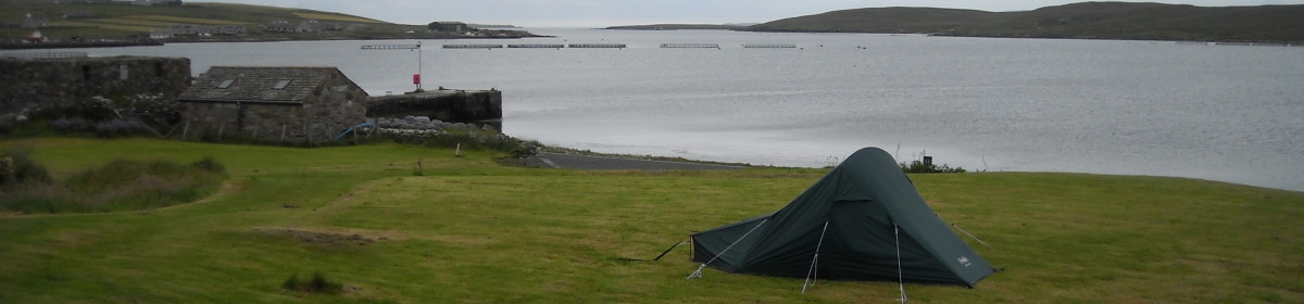
I woke up early after a good first night’s sleep in my tent and was raring to go. It would have made sense to start my walking by going to Minehead and walking back to Porlock and the campsite. Minehead is the beginning of the Southwest Coast Path after all. But as the first bus to Minehead doesn’t get in until almost 12 o’clock and I was ready to get going I decided to leave this walk until tomorrow and do the Porlock to Lymouth stretch today.

The way to the beach led through a marshy area

I started by walking down Sparkhayes Lane to the beach which is a good half mile or so. The beach isn’t a sandy sunbathing type of beach, but rather a pebbley and marshy affair. It was getting the full blast of the wind too. In 1996 the natural shingle ridge across Porlock Bay was breached by a storm, resulting in the flooding of the fields behind at each high tide. This means the official path has had to be moved inland a bit. The signs were quite confusing so I just walked on towards Porlock Weir. I thought I’d know if I was on the old path as it would become impassable and I’d have to turn back. However, once I got to Porlock Weir I saw a much clearer sign that pointed out that I had walked the closed part of the path. Hmm, was that why I’d had to wade through that bit of a slippery, green-slime-filled river?


Porlock Weir
Old groynes on the beach. 

Once I arrived in Porlock Weir (about 2 miles further on) the wind dropped and the sun came out. I sat at a picnic bench looking out to sea and ate my breakfast. Then I had a wander round the tiny village – thatched cottages, boats and an old pub – all very pretty. There’s supposed to be the remains of an ancient forest here which can sometimes be seen when the tide is out. Well, the tide was out, but I couldn’t see the forest. Unless of course, I was confusing it with all the old groynes that were around. 

From here the path was clearly marked all the way and very easy to follow. I only needed to refer to my map when I wanted to check distances or whereabouts I was. It became very wooded and was slightly inland. This meant that apart from occasional tantalising glimpses of the sea through the trees, it felt very much like a woodland walk. This was pretty much the theme for the rest of the day.

A couple of short tunnels in the woods

The path from Porlock Weir led upwards and into Yearnor Wood. A short while on I passed the end of the toll road with big arches for cars to go through. The signs said the toll road goes to Lynmouth but I wasn’t sure about this as on the map it seems to finish at the main road a long way from Lynmouth. Next I had to walk through a couple of tunnels and past signs pointing down to the beach. It was too much of a detour though as I had a bus to catch to get back to the campsite. So I had to be in Lynmouth for 5pm. There are so few buses on these routes that, although I enjoyed myself and saw and did plenty, I still felt rushed a lot of the time. 

Culbone Church

I did stop at Culbone Church. This is really hidden on the banks of a river down in a bit of a valley. The church is dedicated to St Beuno  and is apparently the smallest complete parish church in England at only 35ft long. It’s main structure dates from the 12th century. I had a look inside and immediately felt the hush. It made me realise just how noisy it actually was outside in the woods with so many birds everywhere. 

I didn’t see many people on the walk until I got to County Gate which is the border between Somerset and Devon. There is a car park and so a couple of groups of people had wandered down to the Coast Path from there. They didn’t seem interested in actually going anywhere once they got to the path though, so soon I was on my own again.

The path got a bit hillier and there were quite a few detours where the original path had slipped. One detour seemed almost vertical and was very sandy so my feet couldn’t get any grip. There was nothing to grab hold of and even my sticks kept slipping. That was the only tricky bit though, and even that was only a very short bit. 

Lynmouth can be seen in the distance

All in all I walked about 15 miles and climbed 934m (according to the coastal path website). This wasn’t one big climb, but was continual ascents and descents. By the time I was within the last few miles of Lynmouth my knees were causing me quite a bit of pain and I could feel them swelling up. This slowed me down a bit meaning I only got to Lynmouth about 10 minutes before the bus was due to leave, so I didn’t get chance to have a look around. Despite the pain, I’d really enjoyed my first day’s walking.


There were signs up in quite a few places warning of ticks in the area. I’ve been in plenty of places before with ticks but never had any attach themselves to me. So I had another first when I later got ready for the shower and found 2 small ticks firmly attached to my left leg. Tweezers easily got rid of them, so as long as I don’t contract Lyme disease they weren’t a problem.

England at Wembley

Why I want to see England play at Wembley

Driving down the M6 on my way to Exmoor I passed lots of cars and vans and minibuses with Manchester United flags and scarves flying out of windows or strewn across the back windows. It was cup final day at Wembley: United vs Barcelona in the Champions League.

This made me think about the new Wembley Stadium and how I’d like to see it. I loved the old stadium with the iconic twin towers and it’s a shame it’s gone. But the new one looks like a pretty interesting piece of architecture too. 

I first went to Wembley when I was about 14 and at secondary school. I went along on my brother’s primary school trip to see England vs Holland in a schoolboys’ under 15 game. We won 7-0 and I fancied the Dutch goalkeeper. 

The last time I went into the stadium was when I worked as an extra for the day on a Persil Automatic advert. I had my face painted red and white and was part of an imaginary football crowd. It was a long day but I got paid £50 and well fed. 

In between times I went to the market that was held in the car park on Sundays. I wonder if it still is? I’ve also been to a couple of concerts there. I saw Madonna in her ‘Who’s That Girl?’ tour in the 1980s. I queued up all night for tickets, ticking something of my ‘things I must do’ list of wishes at the time. The ‘thing I must do’ was the queuing up all night, not the Madonna concert. The other concert I saw there was the celebratory concert after Nelson Mandela was freed. The man himself was there and made a speech on stage, as well as a whole host of bands and singers.

So I have good memories of the old Wembley and I’d like to start getting some of the new Wembley. I’ve never been to an England game – the ‘real’ England, not the schoolboys – so it would be great to see them for the first time in the new Wembley. I doubt I’ll see them win 7-0 though!