Braunton to Barnstaple

River walking, swan yoga and Marines doing sit-ups.

Wednesday 6th June, 2012

I had been planning to walk from Braunton to Instow but felt that I had to cut it short as my knees were really sore after the last couple of days’ walking. This is often a problem for me and so I’m used to having to re-jig my plans. I decided to walk only as far as Barnstaple and as this is mainly flat it would give my knees a chance to recover.

I parked at the Leisure Centre in Barnstaple (£1.60 for the day) and crossed the river to the town and the bus station. I got the bus to Braunton getting off at the stop where I’d got on on Monday when I caught the bus to Woolacombe. I went back into the lovely deli and bought a spinach pasty for my lunch. I also sat inside with a coffee and a piece of delicious apple cake before starting my walk.

I backtracked along the river and the Tarka Trail to where I’d finished on the Coast Path on Monday. Today the whole walk was inland and I wouldn’t get to see the coast at all. It was still a lovely walk though, along the former Brauton to Barnstaple Railway. The path is shared with the Tarka Trail Cycleway and so is very easy to walk along.

I’d only just started walking on the official path when I spotted a a hidden pond to the left. I followed a boardwalk down to it and found this lovely oasis with ducks, swans and coots. They had their young with them and I spent some time trying to get a good photo of the cygnets. A family was stood on the boardwalk throwing bread to them and they were all over the place trying to snap it up. Fun to watch, but not easy to photograph. One of the cygnets seemed to have a leg growing out of its back. I worried that it was deformed but maybe it was just resting it. A search on google reveals several pics of cygnets with a leg like this so hopefully it was just relaxing and practising a bit of swan yoga.

Next the path passed the Chivenor Barracks. These stretch for quite a way and are a base for the Royal Marines. I could see houses, buildings and an assault course through the wire fencing. A seat had been conveniently placed so passersby could stop and watch the Marines training. A few were exercising and running but I didn’t get to see them use the assault course.

Moving on from the barracks I came alongside the River Taw which was wide and full of sandbanks, similar to the Torridge yesterday. The weather was much better though and I stopped several times just to sit and enjoy the view.

After 5 miles on this path I reached Barnstaple. I followed the river into town and crossed what I thought was the Long Bridge and the official path bridge. Looking at my map later I realised it might actually have been a bridge a little further up that I should have crossed. I could see the thick dotted green line on the map going as far as this further bridge but was unsure as to whether this was the coast path or the Tarka Trail or both.

I wasn’t too worried at missing part of the path as by this time by knees were sore and I was ready to take my boots off and get in my van.

Instow to Westward Ho!

Rain, rain and more rain (and a pint of lager)

Tuesday 5th June, 2012


This should have been the last of my walks as Westward Ho! is my final destination for this trip. But due to Bank Holiday bus times it made sense to do this walk today as this was the walk with the most convenient buses.

I awoke to a rainy, misty day so made sure I had my waterproofs packed before heading to Westward Ho! It’s only a small place and I soon found the car park opposite the bus stop. The car park was quite expensive though, so I drove a few hundred metres down the road and parked for free on the roadside. It only took five minutes to walk back to the bus stop.

There was a man, a bit older than myself, in the bus shelter pulling on his waterproof trousers. A pint of lager sat on the bench beside him. He said he was based in Clovelly for a few days and walking different parts of the coast path. The stretch from Westward Ho! to Barnstaple was a niggling gap in what he’d already walked and so he wanted to get it done today. As I was getting the bus to Instow and walking back we expected to cross paths part way through the day.

Trousers on, he set off leaving the pint behind. Mustn’t have been his. As I was now the only person in the bus shelter I did wonder if any newcomers would think it was mine. A couple of minutes later a well-dressed woman arrived, tutted at the pint and gingerly picking it up, tipped the contents into the gutter and put the plastic glass in the bin. She didn’t ask if it was mine.

Instow

The bus arrived and then wound it’s way round to Instow. Instow is almost directly east of Westward Ho!, but Westward Ho! is on the coast and Instow is across from Appledore on the far side of the River Torridge. Looking at the bigger section on the map, the estuary of the Rivers Taw and Torridge cuts in from the coast in an easterly direction. Saunton Sands lies to the north of the estuary and the long expanse of sands leading down to Westward Ho! stretch to the south. Following the estuary in a roughly easterly direction leads to the River Taw and Barnstaple. Well before Barnstaple though the River Torridge heads south from the estuary. Huddled in the corner of the estuary and the western banks of the Torridge is Appledore. On the opposite bank is Instow. If this all makes no sense whatsoever you’ll just have to look at the map.

Instow – looking across to Appledore

I arrived in Instow to a light drizzle; I had my waterproof jacket on, but was resisting putting my waterproof trousers on because I’d knew I’d be too hot and rustly in them. A quick wander round and I’d seen most of the village. I called into a deli/takeaway/grocery shop to buy something for breakfast and lunch. I was a bit spoilt for choice but eventually decided on a cheese, salad and onion chutney baguette for lunch which was made up freshly for me. I bought a ‘Jubilee’ flapjack with white chocolate topping and a coffee for breakfast. I also found peanut butter Kitkats and so bought a couple. I love anything peanut butter flavoured and had been looking for these ever since I first heard of them a couple of months ago, but this is the first place I’ve actually seen them for sale. There was nowhere to sit down inside and by this time it was raining really heavily so I didn’t fancy sitting on a bench along the seafront. Instead I stood under the awning of the shop and ate my flapjack whilst balancing my coffee on a box of oranges.

Following the River Torridge to Bideford

The rain showed no sign of letting up so, pulling my hood up, I set off into it. Turning right off the main road I picked up the path which followed the banks of the Torridge to Bideford along the former railway line. This part of the path is also the part of the Tarka Trail; a 180 mile trail following the journey of the fictional Tarka the Otter.

This stretch of the path is flat, straight and easy-going. I got a good rhythm going and made good time. I could see the big road bridge crossing the river at Bideford from quite a way back. The river was sandy and didn’t look particularly deep. I assumed this was low tide and at other times of day the river looks quite different. If not, I don’t see how the ferries to Lundy are able to get from Bideford.

Almost in Bideford

The rain was easing off, or maybe I was just getting used to it. As I came into Bideford the path passed behind buildings and arrived at the former train station. An old train was parked up and had been turned into a cafe. It looked cosy inside and was doing quite a good trade, but I wasn’t ready for a break at this point and so turned right to cross the bridge into Bideford. The Tarka Trail at this point, carries straight on. 

Crossing Bideford Long Bridge

I walked along the quay in Bideford and reached a big car park with a park to the side of it. There are two interesting sculptures here: one a statue of Charles Kingsley, local and author of The Water Babies and Westward Ho!; and the other of a carved wooden ‘helping hand’ supporting a branch of a tree.

Charles Kingsley
‘A Helping Hand’

The path hugged the river to the side of the car park before winding round houses and eventually reaching the river again. I then had a long straight stretch before coming to the outskirts of Appledore. Along here I crossed paths with the man from this morning. He was now reassessing his plans and considering stopping at Instow instead of continuing to Barnstaple.

Leaving Bideford and walking towards Appledore
Walking to Appledore

As the path closed in on Appledore it left the river to go round the large shipbuilding yard and followed the main road into Appledore. I sat on the quay and ate my sandwich and then went for a wander round. Appledore has quaint, narrow streets with pretty, coloured buildings. There’s a ferry running from here across to Instow but I didn’t see it running today. I stopped for a pot of tea in a little teashop that had some good local photographs on the wall. It was crowded and busy as everyone was trying to avoid the rain and so I was quite lucky to get a table.

Quaint colourful streets in Appledore
Leaving the teashop I picked up the path again and walked round the edge of Appledore. I could follow the road west and go straight to Westward Ho! from here, but the path goes north into the sandy, marshy areas of Northam Burrows. There was quite a good road and cars can pay a toll to drive and park here. A few people were out walking their dogs and children, but it was nowhere near as busy as I imagine it would be on a sunny, warm day.
View from Northam Burrows

The rain stopped though there were still very heavy clouds. It was quite pleasant walking here in the stormy light and as I rounded the top of the peninsula the road petered out and became grassland. I walked as close to the water as I could and tried to take dramatic and atmospheric photos of the estuary and the opposite bank. I sat for a while on a bench just enjoying the dark skies and water.

Brooding skies

I left my seat reluctantly knowing I still had a way to go and wanting to avoid the heavy storm that seemed sure to strike at any moment. The path headed south along the third side of the peninsula and led past the golf course back into Westward Ho! and my car.

NB: Westward Ho! is the only place in the UK spelt with an exclamation mark. The name comes from title of Charles Kinglsey’s 1855 novel which was set in Bideford. Entrepreneurs jumped on the bandwagon of the novel’s popularity and saw the chance to develop a new seaside resort to meet the desires of the Victorians who enthused about the benefits of seaside holidays. Charles Kingsley is not the only famous writer associated with Westward Ho! Rudyard Kipling also spent several of his early years living here and wrote ‘Stalky and Co’ about his time at the local college. Of course, Henry Williamson, author of Tarka the Otter, is also connected with this area.
Distance = about 9 miles
Difficulty = easy

Woolacombe to Braunton

A beautiful day for walking along the coast, through sand dunes and on river banks.
Monday 4th June, 2012


Today was my first day of walking. I’d intended to start yesterday by walking the first leg of my planned stretch of the coastal path – Ilfracombe to Woolacombe. Ilfracombe was where I got to last year and so it made sense to start from there this time. However, it was so rainy and misty that I spent the day in Lynton and Lynmouth instead just being a tourist. I didn’t want to walk along the coast and miss out on seeing the wonderful views. It would have been so frustrating knowing they were there but not being able to see them.

Today the weather was much better and it would have been quite nice to walk along this part of the coast. But yesterday I’d picked up a North Devon bus routes timetable booklet in the Exmoor tourist info portakabin in the Lynmouth car park and realised if I jigged my days around a bit I could make much better use of the bus services. Monday and Tuesday were not good days for buses as they were both bank holidays. If I’d left my car in Woolacombe and got the bus to Ilfracombe to start my walk I would have had to change buses and wait for an hour at a junction in the middle of nowhere. Saving this walk for later in the week would mean I could get a direct bus and the journey would only take about 20 minutes.

So instead I started by walking part 2 first. I drove to Braunton and parked on the road just down from the main crossroads. Right by the bus stop was a shop by the name of ‘Devon Made’. I would have assumed it was some kind of craft shop but the smell of baking and coffee enticed me inside and I realised it was much more than this. What a wonderful place. The front part was a bakery, cafe, deli, ice-cream parlour selling local Devon produce. Long tables and benches ran the length of this part of the shop. At the back there were lots of locally made crafts, jars of chutney, chocolates and so on for sale. I bought lunch and breakfast to take away and had a quick cup of coffee inside which I drank whilst looking around. I only had 15 minutes before the bus was due which would take me to Woolacombe, but I was back outside in plenty of time for it.

As the bus rounded the hill above Woolacombe a stunning vista of glittering sea, long sandy beach, houses clutching to the hillside and a massive traffic jam greeted me. By now the day was really hotting up and as it was a bank holiday EVERYONE seemed to have decided that Woolacombe was the place to be. It took a while for the bus to make its way down the hill to the stop at the bottom just by the car park and beach. What had seemed like a nice quaint place from the top of the hill, looked a bit tacky from the bottom and I didn’t want to linger. A quick look around was enough and I set off west along the road running at the top of the beach towards Putsborough Sands. The beach is about 2 miles long and popular with surfers as well as families.

Woolacombe Beach


The path led along a quiet lane with several laybys in which many small campervans were parked. As the laybys overlooked a much quieter part of the beach I could understand why so many people chose to park here.

Looking back towards Woolacombe
Looking fowards towards Baggy Point


From Putsborough Sands the path turned right and up. I was now walking on grass along the top of Napps Cliff and climbing steadily towards Baggy Point. Baggy Point is National Trust land and this part of the SWCP follows the same route as the Tarka Trail (the long-distance trail named after book ‘Tarka the Otter’). Looking back I got great views of the beach all the way back to Woolacombe.

Baggy Point

From Baggy Point I got quite clear views towards Lundy as well as views westwards along the North Devon coast. Walking back along the southern side of this small peninsula led me fairly quickly towards Croyde Bay. The path becomes the main street leading through Croyde and passes the remains of a whale skull that had been washed up on shore in 1915. It looked like rock, but tapping it I could tell it was bone. Shortly after this was a National Trust cafe with a lovely tea garden. I didn’t stop as I wasn’t particularly hungry or thirsty, though if I hadn’t been conscious of the fifteen miles I had to cover today, I probably would have stopped anyway as it looked so inviting.

Remains of a whale that was washed ashore in 1915

Continuing down the main street of Croyde most of the properties I passed seemed to be holiday cottages. As the road became a bit busier the path rose above it, through a gate, to become completely separate. Through a gate at the other end I turned right to head down to the beach and the sand dunes.

Croyde from a distance
The beach here is much smaller than Woolacombe beach, but seemed to have just as many people crammed on to it. There was no real room to walk without feeling that I was intruding on people’s personal space. Multi-generational families were laid out over every inch of the beach baking themselves an unflattering shade of puce. The sea was just as crowded with surfers and boogie boarders. I felt hemmed in and out of place and wanted to get away quickly. On a quieter day it would probably be quite nice here.
Sand dunes at Croyde
I couldn’t find the path at first, but then spotted a small sign pointing behind a hut and up into the sand dunes. The dunes rose up and down with no clear way through them. Children were playing in hollows sliding up and down having great fun. It can’t have been that good for the conservation of the dunes but there were no signs asking people to stay off them and the coast path sign actually pointed straight through the middle of them. It was hard going on my legs and particularly my knees clambering up and down the sand but eventually I could see where I needed to be. I couldn’t get there though, as there was a bit of a stream leading on to the beach blocking my way. I had to backtrack a bit but then found my way onto the far side, joined the beach and, narrowly avoiding stepping on picnic blankets, made my towards steps which I climbed back up to the road.
Saunton Sands
Following the path along the top of a grassy cliff, Saunton Sands soon came into sight. The path rejoins the road here and backtracks a little way. Crossing the road I climbed above it on the opposite side and followed a rather overgrown path parallel to the lengthy beach. I was high enough and in enough overgrowth to be unaware of the road for the majority of the time. The path then dips down, back across the road and leads into the Saunton Sands Hotel car park. Passing through this and winding down around the hotel grounds leads to the beach car park. I got lost in this car park as there were no signs. After doing a tour of the car park I asked someone at the entrance and was pointed in the direction of the road. There was quite a bit of traffic and so it wasn’t too pleasant to walk along and I was glad when the path turned onto Saunton golf club and crossed the edge of the green.
Braunton is not too far from here, but the path heads south past Braunton, then east and north to form a big ‘U’ before finally reaching the outskirts of the town. Tempting as it was to cut straight into town (my knees were getting very tired by this time), I stuck with the path and was glad I did. The path follows an easy track behind the dunes that separate it from Saunton Sands. Part of the dune area is a military practice zone and is fenced off and labelled as a ‘danger area’ on the map.
When the path turned east it became wider before turning north onto a narrow strip of overgrown path along the bank of the river Caen. There were a few boats on the river including one speedboat towing a child behind on a giant tyre. A lone cyclist passed me but I was the only walker here.
The Caen
Eventually I was deposited on a main road on the edge of Braunton. I could have continued following the coast path by almost doubling back on myself and going past the sewage works, but my walk was done for today. Instead I followed the Tarka Trail along the narrowing Caen back into the centre of Braunton and my van.
15 miles
Moderate, mostly flat with the most strenuous bit being the sand dunes

Home

I’m home from a week of jumbled up walking.

I arrived back very late last night from my week walking the North Devon part of the South West Coast Path. It was a gorgeous day – hot, sunny – and after a week in which I’d had lots of rain and wind I didn’t want to waste any of it. I also had one bit of my walk left to do, which would have really niggled at me if I hadn’t been able to complete it. So I walked all day, watched seals, ate an ice-cream, and only left at 5pm. Now I have to spend today sorting out my camping gear, getting everything dry and put away, and then I can think about writing up my walks and sorting out my photos.

This isn’t going to be as easy as it sounds as the whole thing is rather muddled in my head. I’d wanted to walk from Ilfracombe to Westward Ho! and of course it would make sense to start at the beginning and walk to the end. But with the combination of Sunday and the two bank holidays affecting bus services, stiff knees and the poor weather, I ended up walking the route in a really hodge-podge manner and now I’m feeling very confused as to which bits join up with which other bits. I’m sure it will all fall into place when I start working it out, but for now it’s all a bit of a daunting jumble.

Getting things booked

A week off work leaves me feeling organised, clear-headed and on top of things.

I’ve been off work this week as I lost my voice. Careless I know. As a teacher a voice is pretty much essential for my job. Still at least I’ve been able to get loads (and I mean LOADS) of stuff done at home that I normally never get time to do. Like cleaning. I’m feeling very organised and virtuous as I look around my sparkling and tidy home. Having a clear and clean space around me makes my head feel cleaner and clearer too and I feel better able to get on with things. So this afternoon I’ve sat at my clean and clear desk and done all kinds of organising and booking tasks.

I tried to book tickets for myself and a friend to go to Wembley in June to see England play Belgium but they are sold out! I only got an email on Sunday saying that tickets were available and I really didn’t think Belgium were that exciting a team, so I didn’t quite believe the ‘sold out’ sign when I first saw it. Oh well, what’s meant to be is meant to be. I’ll try to go next season instead and maybe I’ll get to see a more interesting team. Not going in June also means I get to go straight down to the South West Coast Path for half term rather than having to detour into London on the way. So that’s a bonus. It would be better to see England when it’s a stand-alone weekend rather than a half term as then it doesn’t impact on anything else and I can actually have a nice weekend in London. So although it would have been nice to get a challenge ticked off, I’m not too disappointed about it.

I did get to book tickets to hear the Dalai Lama speak in Manchester later on in June though. I’m not overly interested in Buddhism but he is pretty important and as I am interested in religions generally it’s a good opportunity to go and hear what he’s got to say. I’m going with a friend’s daughter who is currently studying Theology. Like me, she’s got more of a general interest than a specific interest in Buddhism.

I’ve also booked myself onto a walk led by Stephen Booth in September. It’s a 5 mile walk starting in Castleton and is visiting some of the locations mentioned in his books. No dead bodies guaranteed but it should still be an interesting walk. At the same time as booking it I’ve also joined the Friends of the Peak District. This is an organisation that runs various campaigns to support the Peak District and has different events on offer, the Booth walk being just one of them.

As well as this, I’ve sorted out lots of other things today, like the breakdown cover for my van (actually got a refund!), a magazine subscription, my pension, and changed my Ramblers membership to a group closer to where I live.

So, all in all, I feel like I’ve had a productive day. This would never have been possible if I’d had to go to work. It’s made me realise that for my life to run smoothly and for me to be able to do all the things I want I either have to give up work or get myself a maid and a PA. As I can’t afford either option I guess I’ll just have to accept that for most of the time things just don’t get done.

Stonehenge and Greenland

Thinking about archaeological and Arctic Circle walks.

Womad falls at the wrong part of summer. I’d much rather it was at the beginning of the summer holidays and then I could head south for the festival and then go up to Scotland for the rest of the summer. As it is I’m going to have nine days of holiday time before the festival. I’d spend the first few days at home anyway as I always have lots to do and sort out before I can go away. But nine days! I’ll feel like I’m wasting my precious time off. So I’m going to head down to the Wiltshire / Somerset area and have a few days wandering around before Womad starts.

I’d been wondering what to do for these few days, but not doing any actual research as I’ve got other trips to plans first. I’ve just watched a documentary on iplayer about some new archaeological excavations on Orkney and the programme was linking what was being found there with the later stone age ‘buildings’ of Stonehenge and Avebury and so on. I like this kind of stuff so I started thinking about doing some kind of walk linking the various neolithic remains together. Then just as I was flicking through my ‘Walk’ magazine (it’s the magazine issued by the Ramblers) I came across an article about a proposed Great Stones Way which does exactly that. It links Avebury to Old Sarum via Stonehenge, Silbury Hill, Salisbury Plain, the Kennet and Avon Canal, Woodhenge and Durrington Walls. It all seems quite easy to do on existing paths except for the slight problem of the MOD firing range on Salisbury Plain. The route is about 38 miles and so three easy days would do it, though it should also be possible to walk it in two if need be.

Feeling happy as I always do when a plan starts to formulate in my mind, I turned the page. An article on Greenland. More specifically an article on walking the Arctic Circle Trail which seems to be a cheap way to see Greenland. I’ve been looking at ways of getting to Greenland for a few years and haven’t yet managed to come up with a cheap way of doing it. I’d have to fly from Copenhagen and all in all flights would be about £1000. But once there the walking is free, I can wild camp or stay in free huts and even the canoe I would need to paddle across one of the lakes is free. I’d take my own lightweight dried food and so would only need to buy fuel for my stove. The trail is 165km long and to divide it into a hut-to-hut traverse would mean taking nine days. With a few days spent at either end that would give me about a fortnight in Greenland. I could then spend the rest of the summer cycling and camping in Denmark. I’m already feeling quite excited about this. I won’t be able to do it this summer, but I don’t have anything on my calendar for next year yet!

The Hathersage walk that wasn’t

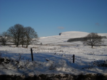
The snow was deep and crisp and even for this winter walk.

snow on the hillsFor a long time now, my small walking group have had this weekend set aside for our Christmas meal and walk. We met in Hathersage yesterday for Christmas lunch in the Little John pub and most of the group stayed over in the pub’s ‘cottage’. I booked too late to get a room at the inn and the youth hostel is closed, so my plan was to drive home last night and return to Hathersage this morning. I only live an hour away so it wasn’t a big issue.
winter sun

Saturday morning I woke to snow. There wasn’t much at home, but once in the hills there was lots. The roads were fairly clear though it was slow going. I arrived late for lunch, but at least I got there (a big achievement for me considering my recent record) and I wasn’t even the last. We had a nice lunch which lasted a few hours and then retired to to the cottage for quizzes, games and drinks. I didn’t want to stay too late as I was concerned about the roads icing up over the tops.

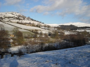
snowy hills snowy hills
I left about 7.30pm and had a fairly easy drive. The roads were a bit snowy, but there wasn’t too much traffic and what there was seemed to be driving carefully and slowly. Then just before Hayfield, on a bend on a hill, there was an accident. I could see the blue flashing lights of police cars and ambulances and the narrow road was completely blocked with traffic starting to back up. I was ready for a long wait. Then I noticed cars pulling out from behind me and turning up a side lane. I’d actually assumed it was just a track leading up to a farm, but unless it was party night at the farm (a barn dance maybe?) it had to be more than that. I made a snap decision to follow the cars and see where they went. I presumed they must know another way into Hayfield and if I stuck close they could lead me.

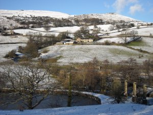
snowy hills

Of course being a little side lane, no more than a single lane track, it wasn’t gritted and was probably a tricky road to drive at the best of times. I slid around a bit, but it was fine. I stuck close enough to the cars in front to see where they were going, but left enough stopping room in case I went into a slide. Just as I wondered what would happen if we all met an oncoming car, one appeared. Luckily it was a 4WD with a driver who knew how to use it. The car went up the side of the bank and was almost at 90 degrees as the driver allowed us all to get past.

New Mills
New Mills

Eventually I got to Hayfield and continued on my way. This morning when I woke up everything was white. After driving home last night, I knew how bad it would probably be further into the Peaks, but decided to give it a try. There wasn’t much traffic and even the grottiest roads looked pretty. Just outside of Glossop everything came to a standstill. The hill was pure ice and cars going down (my direction) were sliding. Cars coming up were … well, they weren’t. The gritters were out, including a couple of men gritting by hand, cars were being pushed, one was being towed by a truck. I finally got clear of the area at 10am which is the time we were meant to be meeting up ready for our 10.30am start. I sent a text to say I probably wouldn’t make it and decided to decide at the end of the road what to do.

Hayfield
Hayfield

As it happened, the road up into the hills wasn’t too bad at all. It had been well gritted and as a main route had already had enough traffic to break the ice and snow up. The fields were white and as I got close to Sparrowpit so was the air. The clouds had dropped and I was driving in a white-out. Once at Tideswell however, the snow abruptly stopped. It looked like a line had been drawn across the countryside – white on the left and green on the right. I made it to Hathersage for 10.45am but had missed the group. I wandered round for a bit in case I bumped into anyone, but didn’t.

I had no idea where they were walking as we still hadn’t decided last night where to go. And after driving through all that snow I really wanted to be out walking in it, not walking in the green hills round Hathersage, something I can do any weekend. So I drove back towards my side of the Peaks. The sun had burnt the clouds off and the sky was blue. I stopped a few times to take photos and then parked up in Hayfield to do a walk along the Sett Valley.

Sett Valley trail in the snow
Sett Valley trail

As it was now afternoon and it gets dark so early I didn’t want to go up into the hills, so instead I walked to New Mills along the Sett Valley trail. Once there I had to turn round and walk back the same way as other routes I could see on the map would have taken too long. But it was nice and I got to see it twice.

Old cemetery DSCN3149

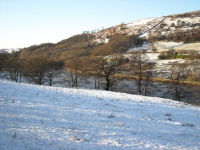
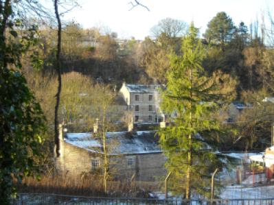
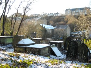
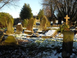
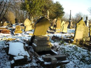
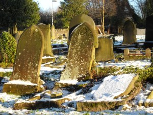
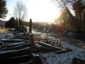
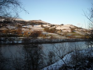
I started following the trail along a well defined path and bridleway from the car park. There were lots of tatalising glimpses of white puffball hills through the trees and the river and lake (is it a lake?) were frozen in parts. The trees were white and the ground underfoot made pleasing crunching noises as I walked. The snow was deep and crisp and even. Where I turned back in New Mills I found an old graveyard with wonky gravestones overgrown with brambles. It looked so dramatic all covered in snow. I wandered around for a while taking photos before heading back to my car and home.

old gravestones old gravestones
I’ve had a lovely day breathing in lovely fresh tingly air, upping my vitamin D intake and making the most of a white world. And I’ve added to my track record of going for walks with my small walking group, not meeting them and doing my own walk instead.

old gravestones snowy hills

Hathersage Christmas Walk no. 1

Micro pigs and money trees on this walk from Hathersage.

Sunday 11th December, 2011


This Sunday my big walking group had its Christmas walk and meal. Next Sunday it’s the turn of my small walking group. Both walks and meals are in Hathersage as this is such a good hub and is on the train line from Manchester to Sheffield, so people living on either side of Pennines have the choice of catching the train instead of driving and so can have a few beers with their Christmas meal.

I chose to drive as it’s much quicker, cheaper and I didn’t feel like drinking a lot anyway.

I picked a friend up at 9am and we were in the pub car park in Hathersage by 10am. The pub we’d chosen was the Millstones and is just outside of Hathersage on the road to Sheffield. The car park had a few goats and a collection of micro pigs and piglets roaming around. The piglets were for sale at £60 each. Tempting, but as I don’t have a parish licence (it’s not that straightforward to buy a pig) I wasn’t able to give in to temptation.

It started to rain just as we began walking, so it was wet-weather gear all the way. We followed a path at the side of the car park downhill into the trees and headed towards the railway and the River Derwent. We walked along a back lane of Grindleford, past Padley chapel, through the Longshaw Estate and ended up at Surprise View from where we walked along the road back to the pub.

We stopped for a coffee break at a shelter behind Padley Chapel and also stopped to take photos of a waterfall and of the money tree on Longshaw Estate. The money tree is a horizontal tree trunk that has been embedded with coins over the years. The coins are firmly hammered in, so there’s no removing them. This is supposed to be a tradition associated with good luck, making a wish (similar to making a wish when throwing a coin into a wishing well) or getting rid of illness (if someone removes a coin they could become ill). See here for an Daily Mail article on money trees.

Once back at the pub we all piled in and took over the toilets so we could get changed into clean and dry clothes. Then, drinks and meal tickets bought and paid for, it was time to attack the carvery. Carveries are great for vegetarians. I piled my plate high with roast potatoes, veggies, bread sauce, stuffing balls, yorkshire puddings, cauliflower cheese, and horseradish sauce. It was delicious and I left the pub a few hours later feeling several kilos heavier than when I’d entered.

Creswell Crags Walk

Caves, quarries and an unexpected tea shop.

Sunday 27th November, 2011


This was a walk in an area I don’t know at all. I’d always thought it too far away for a day walk, but with the help of TomTom I got to the meeting place of Whitwell in just over an hour. This was a walk with my small walking group and for once I actually managed to meet up with them and not be late or go to the wrong car park or do any of the other things I seem to have been good at doing recently.

We found a free car park and there were toilets in the commuity centre across the road. Whitwell itself is a village with a look of a small town. There are quite a few modern houses, pubs, a pizza takeaway place, a hairdresser’s and it has a general look of being fairly low income. Different to many of villages I start walks in where it seems as though you have to be a millionaire to afford a week’s rental in a two up two down.

entrance to Creswell Crags
limestone quary

We began by walking through the town to reach fields and the edge of a limestone quarry to the south of Whitwell. The quarry is fenced off for safety reasons but there was a good path all round the edge. We could see the village of Creswell off to our right as we walked. At the bottom edge of the quarry we left the path and came briefly onto the A616. Then we turned left into the entrance to Creswell Crags. A path that veered off from the road took us to the crags themselves. This rocky gorge has many caves in which have been found bones and skulls of animals not seen in Britain for many thousands of years, and tools used by the first people to inhabit the area. The caves are gated so we couldn’t go in them, though there are tours at certain times.


We walked down both sides of the gorge and then stopped for lunch in a picnic area before walking to the swish new visitor centre for a toilet stop and a quick look round. There’s a bit of a museum in the centre which I didn’t get chance to see. I’d also like to spend more time looking round the gorge and doing the cave tour. So I’ll have to come back. Especially as I now know this area isn’t nearly as far away as I’d thought.


Leaving the visitor centre we walked through a dolomite quarry. The earth was silky black and alien looking with just the one fenced in path going through and lots of warning signs about the dangers of straying into the quarry itself. A few shimmering pools added to the overall effect. I was fascinated by the environment and stopped several times to take photos.


As we reached civilisation again we came across a house with a sign advertising a tea garden. One snap decision later and we all trooped in, much to the surprise of the owner who’d already given up for the day and packed most of the tables and chairs away. The house, called ‘Penny Green’, had a big garden with a swing seat and a little summer house. Running across the bottom was a small stream on the other side of which was a footpath. The lady told us that the footpath was currently being upgraded and when it was finished there would also be a little bridge across the stream so walkers could come directly into her garden from there, thus drumming up more business. We enjoyed sitting in the garden with our drinks, amazed that we could do so in late November. And I was only wearing a fleece and no jacket.

Continuing our walk we followed a small lane to the road near Hoodthorpe and then walked back along paths and through fields (including one with signs warning us to beware of playful horses) to reach Whitwell from the northeast. 

I know where I went

I’ve checked the map and worked out where I walked on Sunday.

Well, I’ve studied the map and worked out where I walked on Sunday. So here it is …

Lunch stop above Bretton Clough

Starting at the eastern end of the village known as Town End (the western end is called Town Head), we wound through a residential street to pick up a footpath that climbed steeply north through a wood. Running along the bottom of the wood is Hollow Brook. At the top of the wood we joined Edge Road and continued northwards until the juction with Sir William Hill Road. Climbing a stile we took the northeast path which followed a wall across the moor. The path curved to the west and then north again along the top of Bretton Clough. This is where we stopped for lunch. After lunch we continued along the path as it dropped down to Bretton Brook and then followed a path on the east side of the brook until we met the road leading into Bretton and the highest pub in Derbyshire. The road in front of the pub heads eastwards and we followed this for a quite a way. It became more of a track than a road and it’s only now looking at the map, that I realise this is the other end of Sir William Hill road. Sir William Hill is a hill alongside this road and has a big pylon perched on top of it. It was in a field just below this pylon that we found the riggweltered sheep. About halfway along this track we turned right and south onto a footpath that headed downhill, crossed a road and then continued more steeply downhill finally coming out near the graveyard of Eyam church.

Map = Explorer OL24
Time = about 4.5hrs